1
of
3
Loading...
Genealogical Surveyor | SKU:
250132461424713
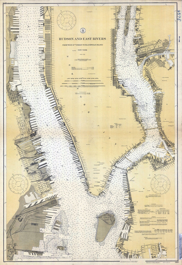
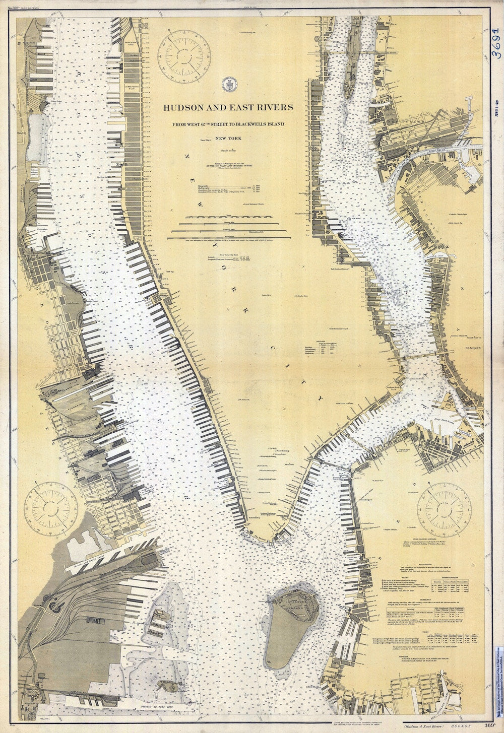
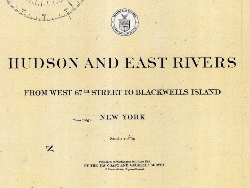
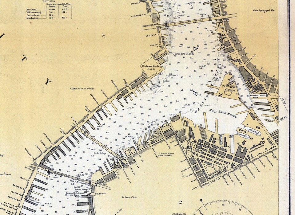
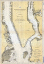
1919 Nautical Chart Map of the Hudson and East Rivers New York Long Island
$34.00 USD
Unit price
/
Unavailable
1919 Nautical Chart Map of the Hudson and East Rivers New York Long Island is backordered and will ship as soon as it is back in stock.
Couldn't load pickup availability
Care information
Care information
All maps are sealed in a plastic poly bag and shipped in a ridged mailing tube. Framed maps are shipped in a sturdy protective box.
Delivery and Shipping
Delivery and Shipping
We ship items the same day or the next day of order depending on the time of day ordered.
Maps are shipped USPS Ground Advantage or UPS Ground.
1919 Nautical Chart Map of the Hudson and East Rivers New York Long...
$34.00 USD
Unit price
/
Unavailable
1919 Nautical Chart Map of the Hudson and East Rivers New York Long Island
22" x 32" Full Color Map Reproduction
Made of heavy weight matte archival paper.
Map shows the shore line detail, water depths, roads, bridges, buildings, and more!
Nice to frame or use for research!
Shipped in a map tube.We ship USPS and UPS. Free shipping and items of certain lengths are shipped UPS.
Payment & Security
Payment methods
Your payment information is processed securely. We do not store credit card details nor have access to your credit card information.