1
of
4
Loading...
Genealogical Surveyor | SKU:
139151351613615
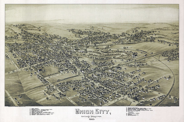
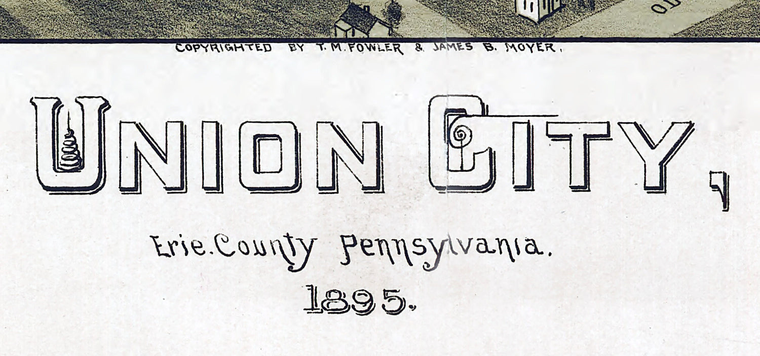
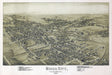
1895 Panoramic Map of Union City Erie County Pennsylvania
$42.00 USD
Unit price
/
Unavailable
1895 Panoramic Map of Union City Erie County Pennsylvania - 16" x 24" Matte is backordered and will ship as soon as it is back in stock.
Couldn't load pickup availability
Care information
Care information
All maps are sealed in a plastic poly bag and shipped in a ridged mailing tube. Framed maps are shipped in a sturdy protective box.
Delivery and Shipping
Delivery and Shipping
We ship items the same day or the next day of order depending on the time of day ordered.
Maps are shipped USPS Ground Advantage or UPS Ground.
1895 Panoramic Map of Union City Erie County Pennsylvania
From
$42.00 USD
Unit price
/
Unavailable
1895 Panoramic Map of Union City Erie County Pennsylvania
16" x 24" or 20" x 30" Full Color Map Reproduction
Plotted on Heavy Weight Archival Matte Paper
Also available in Kodak Fine Art Canvas. Canvas has an additional one inch border.
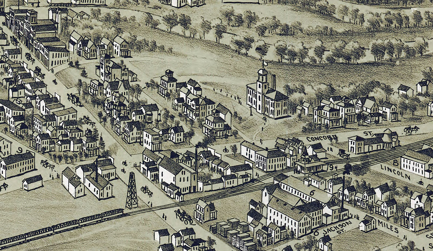
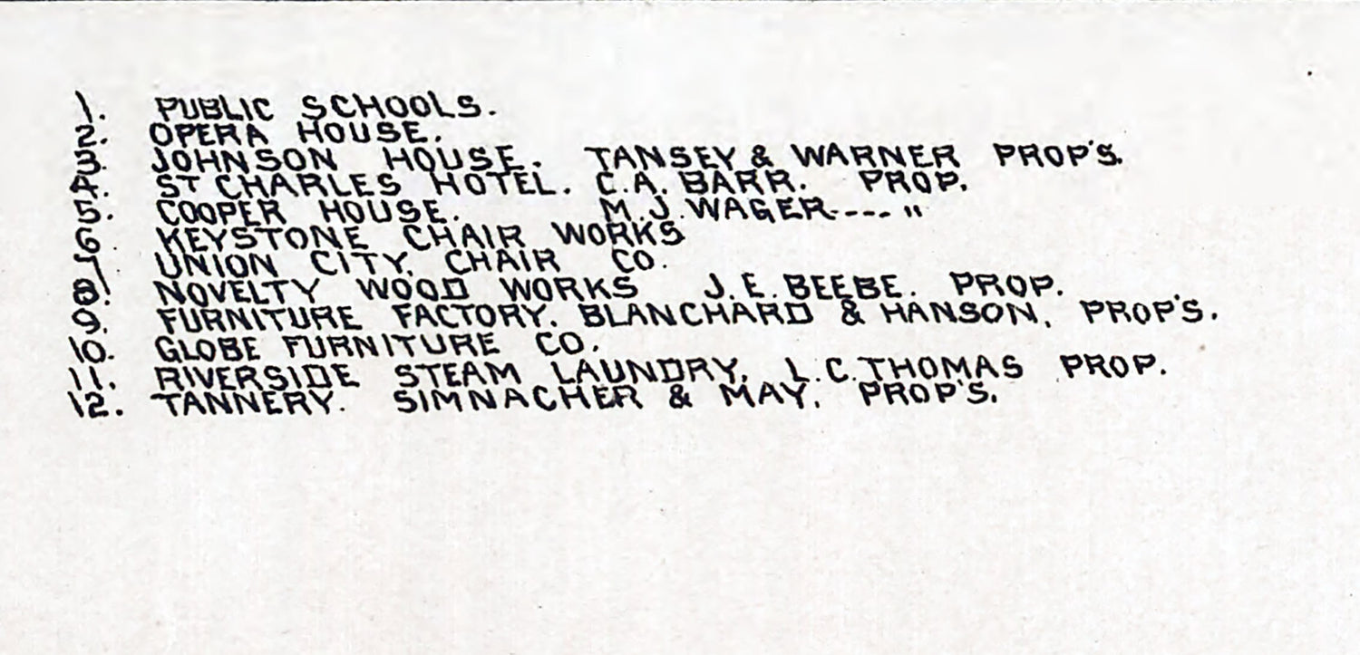
This map shows buildings, place names, roads, rail roads, oil wells, historic places, terrain, and more.
This map is shipped safely in a map tube!
Great for display & research!We ship USPS and UPS. Free shipping and items of certain lengths are shipped UPS.
16" x 24" or 20" x 30" Full Color Map Reproduction
Plotted on Heavy Weight Archival Matte Paper
Also available in Kodak Fine Art Canvas. Canvas has an additional one inch border.
This map shows buildings, place names, roads, rail roads, oil wells, historic places, terrain, and more.
This map is shipped safely in a map tube!
Great for display & research!We ship USPS and UPS. Free shipping and items of certain lengths are shipped UPS.
Payment & Security
Payment methods
Your payment information is processed securely. We do not store credit card details nor have access to your credit card information.