1
of
3
Loading...
Genealogical Surveyor | SKU:
105281012910228
1865 Map of Saint Augustine Region Moultrie Creek in Saint Johns County Florida
$35.00 USD
Unit price
/
Unavailable
1865 Map of Saint Augustine Region Moultrie Creek in Saint Johns County Florida - Heavy Weight Matte is backordered and will ship as soon as it is back in stock.
Couldn't load pickup availability
Care information
Care information
All maps are sealed in a plastic poly bag and shipped in a ridged mailing tube. Framed maps are shipped in a sturdy protective box.
Delivery and Shipping
Delivery and Shipping
We ship items the same day or the next day of order depending on the time of day ordered.
Maps are shipped USPS Ground Advantage or UPS Ground.

1865 Map of Saint Augustine Region Moultrie Creek in Saint Johns Co...
From
$35.00 USD
Unit price
/
Unavailable
1865 Map of Saint Augustine Region Moultrie Creek in Saint Johns County Florida
11" x 14" Full Color Map Reproduction
Map is made of heavy weight matte archival paper or museum grade fine art canvas.
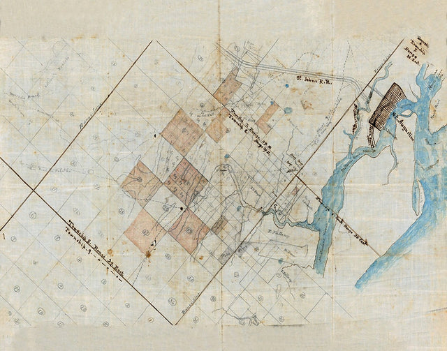
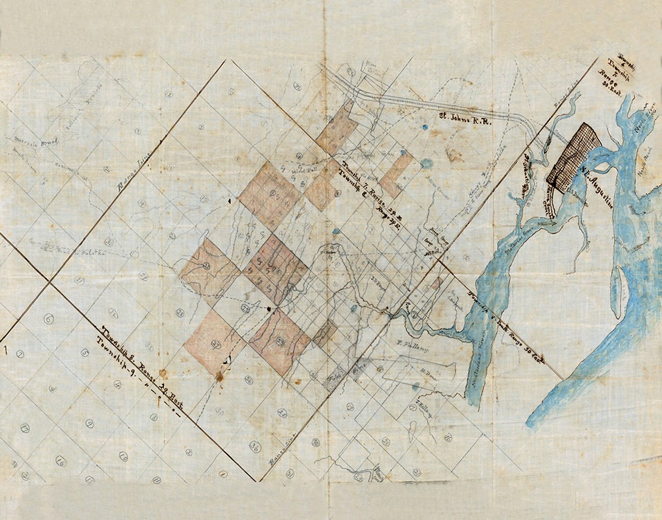
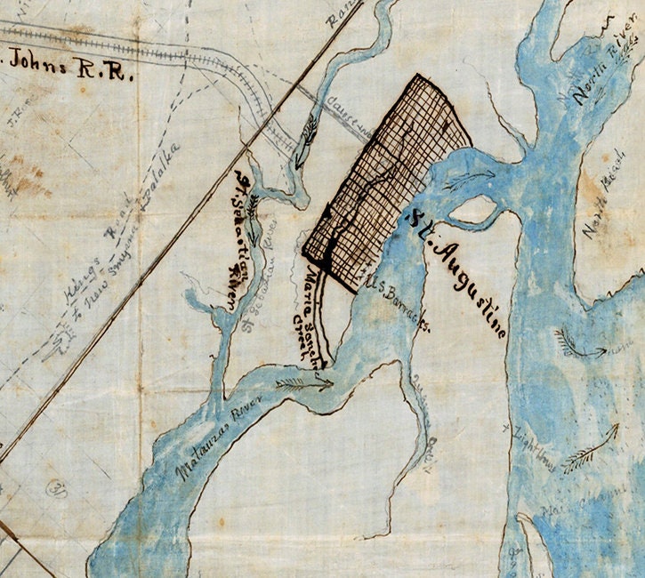
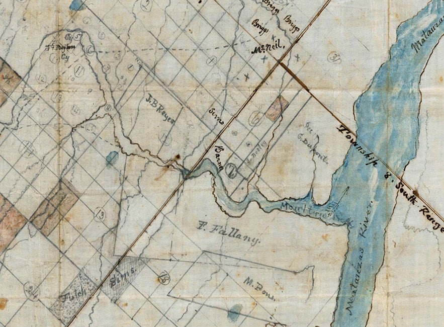
This early Civil War Year Map shows the region around Saint Augustine including the City Itself,
North Beach, Matanzas River, Moultrie Creek, Fort Peyton, Kings Road, the Saint Johns Rail Road, and
many other property owners, boundaries, roads, and places of interest. A very rare historic map of
the region. Great to display and research!
Shipped in a roll map tube.We ship USPS and UPS. Free shipping and items of certain lengths are shipped UPS.
11" x 14" Full Color Map Reproduction
Map is made of heavy weight matte archival paper or museum grade fine art canvas.
This early Civil War Year Map shows the region around Saint Augustine including the City Itself,
North Beach, Matanzas River, Moultrie Creek, Fort Peyton, Kings Road, the Saint Johns Rail Road, and
many other property owners, boundaries, roads, and places of interest. A very rare historic map of
the region. Great to display and research!
Shipped in a roll map tube.We ship USPS and UPS. Free shipping and items of certain lengths are shipped UPS.
Payment & Security
Payment methods
Your payment information is processed securely. We do not store credit card details nor have access to your credit card information.